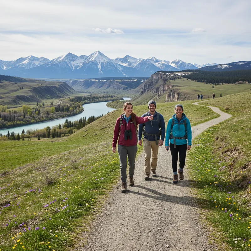
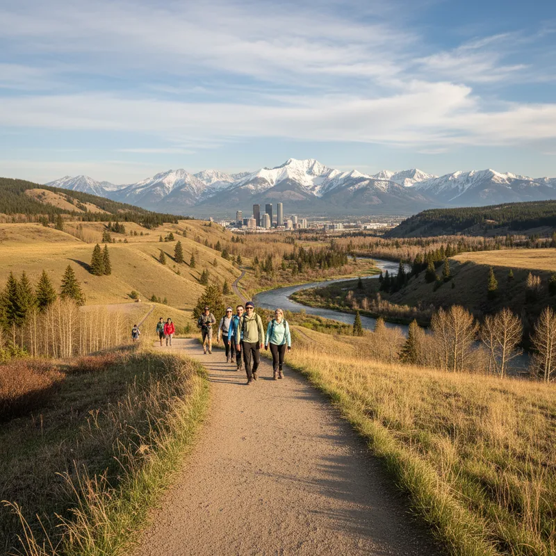
Spring hiking near Calgary is a choose-your-own-adventure between dry pathways, surprise ice, and the kind of mud that can swallow a boot. April and May can still bring winter-level storms, so this guide focuses on lower-elevation, early-melt options that are typically more accessible, more snow-free, and more forgiving than high alpine routes.
These are not promises of perfect conditions, the Rockies do not do guarantees, but they are smart bets for shoulder season. Before you go, check the latest closures and advisories, pack traction and layers, and be ready to turn around. If you need a reminder that spring can still bite, read Claritive’s coverage of how quickly conditions can change during a storm, like Calgary braces for heavy spring snowstorm with up to 25 cm expected.
Below you’ll find 15 hikes within roughly two hours of Calgary, with addresses, parking notes, fees, and what makes each trail a good early-season pick.
What to expect on April and May hikes near Calgary (snow, mud, and safety)
In early spring, the best strategy is to aim for sun-exposed slopes, valley-bottom riverside trails, and well-built paths with good drainage. North-facing forest routes hold ice longer, while open prairie and foothills often melt out first.
- Traction matters: microspikes are often the difference between fun and sketchy on packed spring ice.
- Mud etiquette: stay on trail, even if it’s muddy, widening the trail damages vegetation.
- Creek crossings: runoff ramps up quickly in May, avoid risky crossings.
- Wildlife: bears can be active in spring, carry bear spray and know how to use it.
For current closures and trail reports in Kananaskis, Alberta Parks is the most reliable official source: Alberta Parks trail reports.
Best low-snow hikes in Kananaskis near Calgary (April and May)
Kananaskis often has the best shoulder-season variety, but it also has the most variability. The key is sticking to lower valleys and south-facing routes, and planning around the Kananaskis Conservation Pass.
Fullerton loop (Elbow Valley, Kananaskis)
Why it works in spring: a popular loop with generally good drainage, forest cover, and flexible turnaround options if conditions deteriorate.
Distance: about 9 km loop, time: 2.5 to 3.5 hours depending on pace and mud. Trailhead: Elbow Valley Trailhead Day Use, off Highway 66, Kananaskis, AB. Fees: Kananaskis Conservation Pass, $15 per day or $90 per year per vehicle, buy online at alberta.ca. Hours: day use area access generally 7 am to 11 pm.
Local tip: go early to beat parking, and bring gaiters, spring mud is real in the lower forest.
Grotto Canyon (near Exshaw, Kananaskis)
Why it works in spring: lower elevation and a wide approach make this a shoulder-season favourite, but expect ice lingering in shaded sections.
Distance: roughly 4 km return to the canyon narrows, longer if you wander. Trailhead: Grotto Canyon Day Use, Bow Valley Trail, near Exshaw, AB. Fees: Kananaskis Conservation Pass. Hours: day use access typically 7 am to 11 pm.
Practical detail: microspikes are often useful in April, and families should watch for icy creek-edge sections.
Barrier Lake lookout (Bow Valley Provincial Park)
Why it works in spring: short, scenic, and relatively low, this is a good “first hike back” with big views for modest effort.
Distance: about 4.8 km return, elevation gain: around 300 m. Trailhead: Barrier Lake Day Use, Highway 40, Kananaskis, AB. Fees: Kananaskis Conservation Pass. Hours: day use access typically 7 am to 11 pm.
Local tip: this area can be windy, pack a shell even if Calgary is warm.
Heart Creek trail (Lac des Arcs, Bow Valley)
Why it works in spring: a short family-friendly outing that often melts out early, with a creek and small canyon walls that make it feel like a bigger adventure.
Distance: about 4 km return. Trailhead: Heart Creek Day Use, Highway 1, near Lac des Arcs, AB. Fees: Kananaskis Conservation Pass. Hours: day use access typically 7 am to 11 pm.
Practical detail: run-off can make sections slick in May, bring poles for balance.
Best early-season hikes near Canmore (low-elevation and accessible)
Canmore sits lower than many classic Banff hikes, and south-facing slopes above town can melt quickly. Expect busy trailheads on weekends, and plan for paid parking where applicable.
Grassi Lakes (Canmore)
Why it works in spring: a short, well-travelled trail with options, often one of the first “mountain lakes” to become accessible in May.
Distance: about 3.2 km loop. Trailhead: Grassi Lakes Trailhead, Spray Lakes Road, Canmore, AB. Fees: no park fee, but some Canmore lots are paid. Hours: daylight access, check signage at trailhead.
Practical detail: there are two routes, the “upper” route is steeper and can hold ice longer.
Policeman’s Creek boardwalk (Canmore)
Why it works in spring: if you want truly accessible, mostly snow-free walking, this is a reliable option, great for strollers and anyone easing into hiking season.
Distance: choose-your-own, many people do 2 to 5 km. Access point: near Canmore Civic Centre, 902 7 Ave, Canmore, AB. Fees: free. Hours: public pathway, open at all times.
Local tip: pair it with coffee in downtown Canmore and treat it as a “conditions scout” day.
Ha Ling Peak (Canmore, for fit hikers in late spring)
Why it can work in May: it’s steep and often transitions to dry conditions sooner than shaded valley trails, but you can still hit snow on top.
Distance: about 6 km return. Trailhead: Goat Creek Trailhead, near Canmore Nordic Centre Provincial Park, Canmore, AB. Fees:Time: 2.5 to 4 hours for many hikers.
Practical detail: if it’s muddy, choose a different trail, the steep grade gets damaged quickly.
Best spring hikes near Bragg Creek and the foothills (often snow-free first)
If your priority is “least snow,” the foothills are usually your best friend in April. These routes can be windy, and they are exposed, so you’ll feel weather changes fast.
Prairie Mountain (near Bragg Creek)
Why it works in spring: a classic conditioning hike, often doable in shoulder season with traction, and it’s close to Calgary.
Distance: about 7.6 km return. Trailhead: across from the winter gate near Elbow Falls, Highway 66, Kananaskis, AB. Fees: Kananaskis Conservation Pass. Time: 2.5 to 4 hours.
Practical detail: microspikes help on hard-packed spring snow, poles help on the descent.
Moose Mountain trail (Bragg Creek area, shoulder-season option)
Why it can work: when higher routes are still wintery, Moose Mountain can be a good training hike, but spring conditions vary widely, and it can be muddy.
Trailhead area:Fees:</strong varies by access point, often Kananaskis Conservation Pass if in provincial recreation areas.
Local tip: if the access road is deeply rutted or soft, turn around, it’s not worth getting stuck.
Best spring hikes in Banff National Park (lower valley trails)
Banff National Park trails tend to be well maintained, but higher elevations around Lake Louise hold snow longer. Focus on Banff townsite and Bow Valley floor routes early season. You will need a Parks Canada pass.
Fees: Parks Canada Discovery Pass or daily pass. Official info: Parks Canada admission.
Johnston Canyon to the lower falls (Banff National Park)
Why it works in spring: a built trail with railings that’s often manageable even when conditions are variable, though it can be icy in shaded canyon sections.
Distance: about 2.5 km return to the lower falls, 5 km return to upper falls, longer to Ink Pots. Trailhead: Johnston Canyon Parking Lot, Bow Valley Parkway (Hwy 1A), Banff National Park, AB. Fees: Parks Canada pass. Hours: day use, accessible anytime, seasonal services vary.
Practical detail: go early or late to avoid congestion, spring weekends can feel like a parade.
Fenland trail (Banff townsite)
Why it works in spring: flat, forested, close to town, and often one of the first “real nature” walks to dry out.
Distance: about 2.1 km loop. Trailhead:Fees:Hours: day use.
Local tip: if you’re testing new boots after winter, this is a low-commitment place to do it.
Tunnel Mountain (Banff)
Why it works in spring: a short summit with a big payoff, often doable in April or May with traction in icy spots.
Distance: about 4.5 km return. Trailhead:Fees:Time:</strong 1.5 to 2.5 hours.
Practical detail: expect patchy ice on shaded switchbacks, microspikes can help.
Lake Minnewanka shoreline (Banff)
Why it works in spring: the lakeside trail is lower and often accessible early, with flexible turnarounds.
Distance: choose-your-own out-and-back. Trailhead:Fees:Hours:</strong day use.
Practical detail: wind off the lake can make it feel much colder than Banff town.
Best spring hikes near Calgary that are accessible and mostly paved
If you want true “snow-free” reliability, stay in Calgary or on lower valley pathways that are plowed or heavily used. This is also a solid approach when spring storms make highway driving risky, a reality Calgarians know well, as seen in Calgary snowstorm causes over 160 crashes.
Fish Creek Provincial Park (Bowness? no, south Calgary)
Why it works in spring: massive trail network, many paved and quickly cleared by use, plus lots of access points to match your neighbourhood.
Address (access point):Fees:Hours:</strong 5 am to 11 pm for Alberta provincial parks day use (seasonal variation posted on-site).
Practical detail: choose gravel singletrack after a dry spell, stick to paved pathways if it’s thawing.
Nose Hill Park (Calgary)
Why it works in spring: exposed, windy, and often snow-free first, with wide informal routes that drain quickly.
Address (popular access):Fees:Hours:</strong 5 am to 11 pm.
Local tip: this is a great sunset walk, but bring a layer, it cools fast.
Glenbow Ranch Provincial Park (Cochrane area)
Why it works in spring: rolling foothills terrain above the Bow River that can dry early, with a mix of wide trails ideal for muddy season.
Address:Fees:Hours:</strong typically 9 am to 4 pm in winter, longer in summer, check Alberta Parks signage for seasonal hours.
Practical detail: pack wind protection, this benchland can be gusty.
How to choose a low-snow trail (and avoid mud) near Calgary
- Go lower:</strong Banff town, Bow Valley floor, foothills parks.
- Go south-facing:</strong faster melt, less ice.
- Start later:</strong morning freeze can mean ice, afternoons mean mud.
- Bring traction:</strong microspikes cover the in-between season.
- Have a Plan B:</strong city pathways if the highways look ugly.
Neighbourhood matters for a quick escape, if you’re picking a base for trail access, our local breakdown in Calgary’s best neighbourhoods: a 2026 guide to researching and comparing can help you map drive times to the west and south edges of the city.
Permits, parking, and costs for spring hiking near Calgary
Kananaskis Conservation Pass:alberta.ca</a>.
Parks Canada pass:parks.canada.ca</a>.
Transit and shuttles:Cairns’ best eats: the ultimate guide to restaurants for dinner (2026)</a>, a reminder that logistics matter as much as the destination.
Early spring packing list for Calgary-area hikes
- Microspikes, trekking poles
- Waterproof hiking boots, gaiters
- Extra socks, warm layer, shell jacket
- Bear spray, and an accessible holster
- Offline map, headlamp, first-aid kit
Spring hiking is about being adaptable. If you wake up to a fresh layer of snow, pick a city walk, or postpone. It’s a lot easier than dealing with a vehicle slide on Highway 1 or 40, especially after conditions swing quickly.