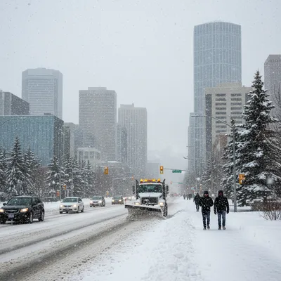
Calgary is bracing for a dramatic return to winter as Environment and Climate Change Canada (ECCC) has issued a special weather statement for the city and surrounding areas, warning of heavy snow and challenging travel conditions from Thursday night through to Saturday morning.
The alert comes after a week of wild temperature swings that saw Calgarians enjoying summer-like conditions with highs of 22 C on Monday and Tuesday. That taste of summer will be a distant memory as a cold front sweeps through, bringing plunging temperatures, strong winds, and significant snowfall.
According to the ECCC, the storm will bring "rapidly deteriorating weather conditions" with localized heavy bands of snow. While accumulation will be highly variable, some areas could see a quick 10 centimetres. The agency also warns of blowing snow developing overnight Thursday and lasting into Friday afternoon, which will cause poor visibility on area roads and highways.
Sudden temperature plunge
The winter-like blast follows a significant temperature drop on Thursday, which saw a high of just 5 C. The forecast for the next few days shows a stark contrast to both the week's earlier warmth and the seasonal average for late April, which is normally a high of 13 C and a low of 0 C.
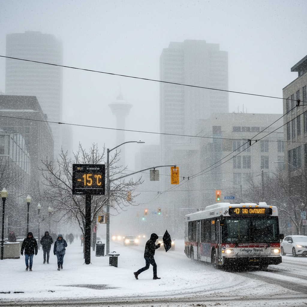
Thursday evening is expected to bring a chance of rain or flurries as the temperature drops to a low of -2 C, though the wind chill could make it feel as cold as -9 C. Friday is expected to be colder still, with a high of only 1 C and a morning wind chill of -10 C. There is a 60 per cent chance of flurries throughout the day, with winds forecast to gust up to 70 km/h. These strong winds have already caused disruptions, forcing the popular Parade of Wonders, the kick-off for the Calgary Fan and Entertainment Expo, to be moved indoors. Similar issues have surfaced in Brampton, where residents voiced crime concerns at a public safety forum.
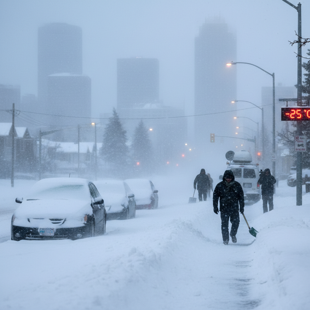
The cold snap is set to continue into the weekend. ECCC predicts periods of snow could persist on Saturday as temperatures hover between -2 C and -6 C. Sunday will remain chilly and cloudy with a high of 2 C and a low of -5 C.
Travel disruptions expected
Officials are advising motorists to prepare for quickly changing and deteriorating travel conditions. The combination of snow, which could start as a rain-snow mix on slick roads, and strong winds creating poor visibility is a recipe for hazardous commutes.
Drivers should allow for extra travel time and maintain safe following distances. The special weather statement notes that major routes like Highway 2 and sections of Highway 1, particularly west of the city, could be heavily impacted by the storm. In a city where traffic can be snarled by even a light dusting of snow, a rapid accumulation of 10 cm could cause significant delays.
The broader weather warning extends across a large swath of southern and central Alberta, stretching from just north of Fort Macleod up to Ponoka, and from Canmore in the west to Drumheller in the east. Edmonton is not included in the main statement but is forecast to receive a couple of centimetres of snow as the system moves through.
A history of volatile spring weather
For long-time Calgarians, this kind of 'weather whiplash' is a familiar, if unwelcome, feature of spring in the foothills. The city is notorious for its ability to cycle through multiple seasons in a single week, or even a single day. The dramatic shift from patios to parkas is a quintessential Calgary experience.
The city has a long history of severe and unpredictable weather events. One of the most infamous was the September 1991 "Hail Hammering," which saw tennis ball-sized hailstones pummel the city for 30 minutes, causing widespread damage to homes, vehicles, and crops. At the time, it was the costliest hailstorm in Canadian history.
More recently, a devastating hailstorm in June 2020 caused over $1.2 billion in insured damages, ripping siding from homes and shattering windshields across the northeast. While the incoming snowstorm is not expected to be as destructive, it serves as another reminder of the powerful and often extreme weather patterns that can impact the region with little warning.
A return to more seasonal temperatures is expected to begin for the new work week, with Monday's forecast calling for a high of 9 C, though this is still several degrees below the normal high for this time of year. For more detailed and up-to-date information, residents can consult the official ECCC alerts.