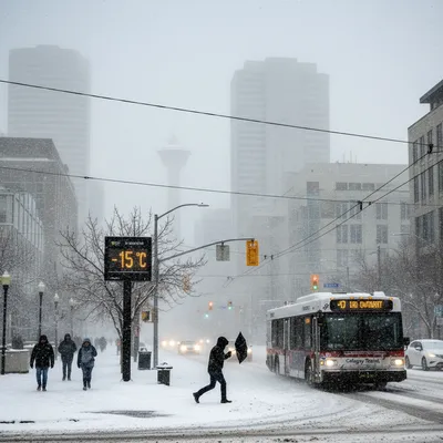
Calgary is bracing for another significant spring snowstorm, with Environment Canada issuing a snowfall warning for the city and surrounding areas beginning Wednesday afternoon.
Forecasters are predicting total accumulations between 15 and 30 centimetres by the time the system moves out on Thursday. The precipitation is expected to start as rain on Wednesday afternoon before transitioning to heavy, wet snow as temperatures drop.
“This afternoon, we’ll start to see the precipitation move in, and that will probably start in the form of rain, and then switch over sometime in the afternoon towards snow,” said Terri Lang, a meteorologist with Environment and Climate Change Canada. “Through that switch over, we often see the really big flakes. really juicy, lots of moisture in them.”
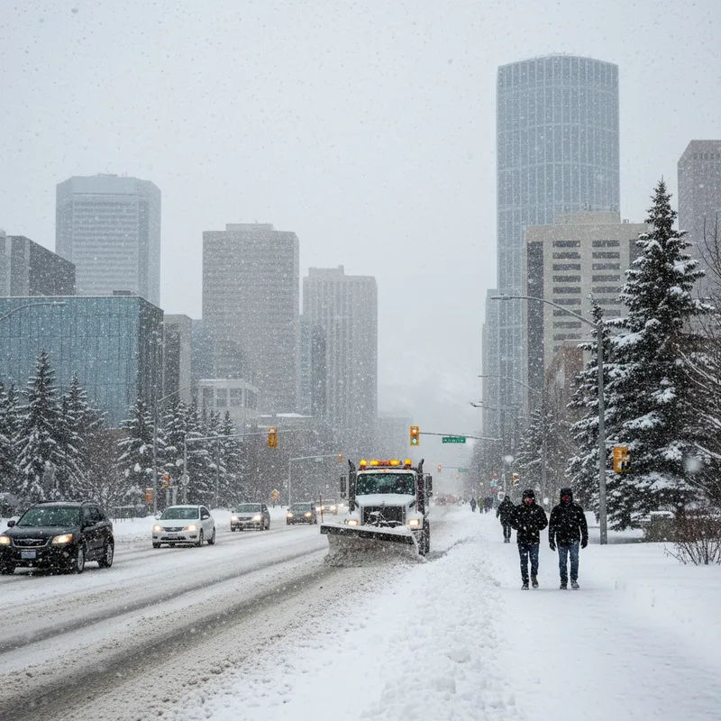
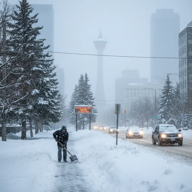
The heaviest period of snowfall is anticipated during the late afternoon and early evening commute on Wednesday, which could create challenging travel conditions. Lighter snow is expected to continue overnight into Thursday. Officials are warning that visibility may be poor and conditions on the roads could change or deteriorate rapidly.
Difficult travel conditions expected
The timing of the storm, hitting just as the afternoon commute begins, is a major concern for traffic authorities. Recent spring snowfalls have caused chaos on city roads. Just a few weeks ago, an unexpected blast of heavy snow during the morning rush hour led to more than a hundred crashes due to treacherous conditions, particularly in the north part of the city where whiteouts were reported. In Brampton, a similar incident where a suv rear-ended a truck resulted in one fatality and one person critically injured.
Drivers are being urged to adjust to the changing conditions. “Of course, the temperature will drop overnight, so any initial melting that happens will stop, freeze up, and things will really start accumulating after that,” Lang said. This freeze-thaw cycle can lead to icy patches on roads and sidewalks, increasing the risk of accidents and falls.
This week's storm is the result of a more organized, large-scale weather system, known as a synoptic system. Lang noted that this means the snowfall will be widespread across the city. “This is a more organized system. what we call a synoptic weather system. It’s a low-pressure system,” she explained. “I think everybody’s going to be getting in on the fun this time around.” This contrasts with other recent snow events that may have been more localized.
City road crews will be on high alert. Problems with potholes have plagued Calgary drivers this year after a season of wildly fluctuating weather, and another heavy, wet snowfall could exacerbate the issue.
A typical, volatile Alberta spring
While the sudden return to winter may be frustrating for Calgarians eager for warmer weather to finally arrive and enjoy the city's many patios, Lang emphasizes that these dramatic swings are characteristic of spring in southern Alberta.
“You’ve got the mountains there that play a role in where the weather systems go, plus, we still have the colder air lurking to the north, but the warmer air is trying to come up from the south,” Lang said. “It’s that clash of that cold air and the warmer air to the south that causes these weather systems, and because warm air can hold more moisture, that’s why we tend to get the heaviest snowfalls in the spring and in the fall.”
It’s actually quite a volatile month for weather. All the seasons are represented through the spring in southern Alberta.
Historically, April is Calgary's second snowiest month, just behind March. The "volatile" nature of the season means residents can experience everything from winter storms to summer-like warmth, sometimes within the same week. This meteorological clash of seasons is a well-known phenomenon in the region.
History of severe weather
Southern Alberta is no stranger to severe weather events, which can have significant impacts. One of the most costly weather events in Canadian history was the Calgary hailstorm of June 2020, which caused over $1.2 billion in insured damages. That storm produced hail larger than softballs in the city's northeast, delivering its devastating impact in just 15 to 20 minutes.
While snow is different from hail, this week's storm is another reminder of how quickly powerful weather systems can develop and impact the city. A changing climate is expected to continue influencing the frequency and intensity of such events. As the atmosphere warms, it can hold more moisture, potentially leading to heavier precipitation events, whether rain or snow.
As the snow begins to fall, Calgarians are being advised to stay updated on the latest forecasts and road conditions. Environment Canada warns that travel may be challenging, and preparing for winter-like conditions is the best course of action. The full impact of the storm will become clearer as it moves through the region overnight and into Thursday.