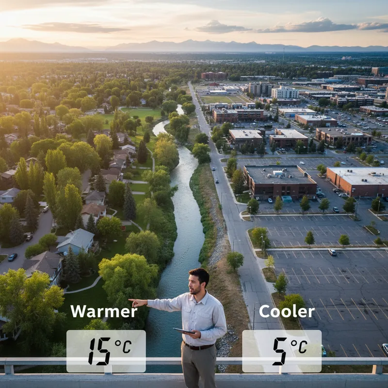
New analysis of Calgary’s urban landscape reveals a stark temperature divide, with some neighbourhoods experiencing summer surface temperatures nearly 10 degrees Celsius warmer than others. The research, conducted by Calgary-based geoscientist Vasylenko Yevhen, highlights a significant disparity in urban heat, driven primarily by the amount and quality of vegetation in a community.
Yevhen’s work, which uses massive public data sets to map surface temperatures, identifies a clear trend: the more concrete and asphalt, and the less green space, the hotter the neighbourhood. His findings show an average surface temperature difference of almost 10 C between the city’s most tree-canopied communities and its most densely developed areas.
“The correlation between surface temperature and surface condition in Calgary. it’s just finding gaps in community greenery,” Yevhen says. “We have huge inequity between some communities because some just don’t have as many trees.”
Cool west, hot east
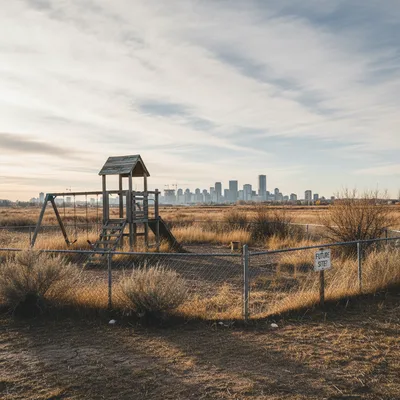
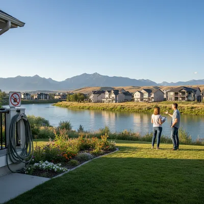
The research pinpoints Calgary's hottest neighbourhoods, with Marlborough, Rundle, Penbrooke Meadows, Manchester, and Forest Lawn all recording average surface temperatures above 37.3 C last summer. These areas, concentrated in the city’s east, contrast sharply with the coolest communities, including Osprey Hill, Roxboro, Discovery Ridge, Rideau Park, and Eau Claire, which all averaged below 30 C. Osprey Hill was the coolest at 28.85 C.
This data suggests a broader geographical trend of a cooler west side and a warmer east side. The most extreme overheating is found in industrial zones and commercial districts, which feature large buildings, extensive parking lots, and a noticeable lack of mature trees.
However, Yevhen’s analysis goes beyond simply counting trees. He stresses that the health of the vegetation is as crucial as its presence. In some warmer areas like Marlborough and Forest Lawn, satellite data indicates that the existing greenery is not providing a significant cooling effect. “We see many trees and shrubs, but with the satellite data, I see these trees don’t work,” he said. “They’re small and semi-dry.”
Satellite data reveals heat map
To create his detailed maps, Yevhen, who immigrated to Calgary from Ukraine in 2022, draws on publicly available data from NASA’s Landsat 8 and 9 satellites and the European Space Agency’s Sentinel-2 mission. Collecting information from June to August 2025, he uses optical and radar data to classify different types of land surfaces. such as pavement, buildings, and vegetation. and overlays this with land surface temperature data.
A geologist and geoscientist in training with over a decade of experience, Yevhen shares his findings on his blog and social media. He aims to make complex environmental data accessible to the public, helping residents understand the warming trends in their own backyards and how these patterns affect their daily lives.
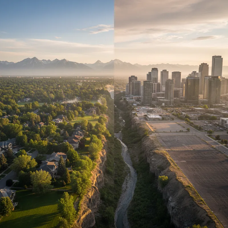
His work aligns with a growing body of global research on the "urban heat island effect," where cities become significantly warmer than surrounding rural areas. Factors like population density, landscape design, and building materials all contribute to this phenomenon. Understanding these factors is a key part of responsible urban planning and development. In Calgary, for instance, the city uses tools like the EnviroSite report to investigate the historical environmental state of properties, which can be crucial for redevelopment in older industrial areas that are now becoming residential.
What is the urban heat island effect?
The City of Calgary also uses its own urban heat map, which confirms Yevhen’s findings. Stacey Rector, the city’s lead in climate adaptation, says the city’s data shows “the warmest areas do tend to be paved spaces, and the coolest spaces tend to be green areas and water bodies.”
Rector explains that the effect is caused by a combination of three main factors. First, dark surfaces like asphalt and roofing absorb and retain more solar radiation than natural landscapes. “Heat absorbing surfaces … stay warm longer than the vegetation they might have replaced, and then they slowly release that heat back into the air,” she says.
Second, the loss of vegetation, particularly mature trees, removes a powerful natural cooling mechanism. Plants provide shade and also cool the air through a process called evapotranspiration. Finally, human activities, including vehicle traffic, industrial processes, and the waste heat from air conditioning systems, all add to the ambient temperature of a city.
Health, energy, and infrastructure at risk
The consequences of urban heat are wide-ranging, impacting public health, energy consumption, and municipal infrastructure. Rector notes that higher temperatures pose significant heat-related health risks, especially for vulnerable populations such as children, seniors, outdoor workers, and individuals with pre-existing medical conditions.
Urban heat also puts a strain on energy grids as demand for air conditioning rises, leading to higher electricity bills for residents and businesses. Furthermore, extreme heat can accelerate the deterioration of public infrastructure like roads and bridges, increasing maintenance costs and potentially adding to the burden on taxpayers. This comes at a time when many Calgary homeowners are already facing property tax increases.
The city is now focusing on nature-based solutions to combat the heat. This involves preserving and expanding natural spaces like wetlands and green areas, but the primary focus is on expanding Calgary's urban forest. "Big trees work like refrigerators," Yevhen says, emphasizing their critical role in cooling urban environments.
As part of this strategy, the city recently launched a program to provide 10,000 free trees to Calgarians for planting on private property. The initiative aims not only to cool the city but also to reduce erosion, improve air and water quality, and enhance biodiversity. The success of such programs will be vital as the city continues to grow and adapt to a changing climate, with related initiatives like permanent outdoor water schedules also under consideration to manage environmental resources.