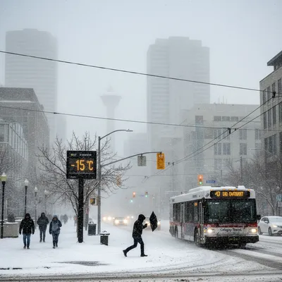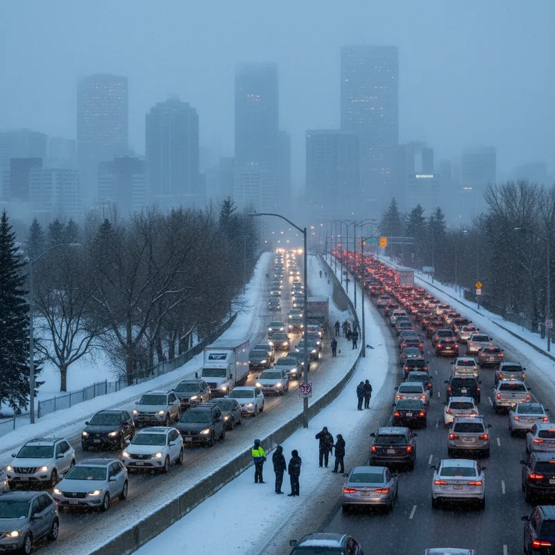
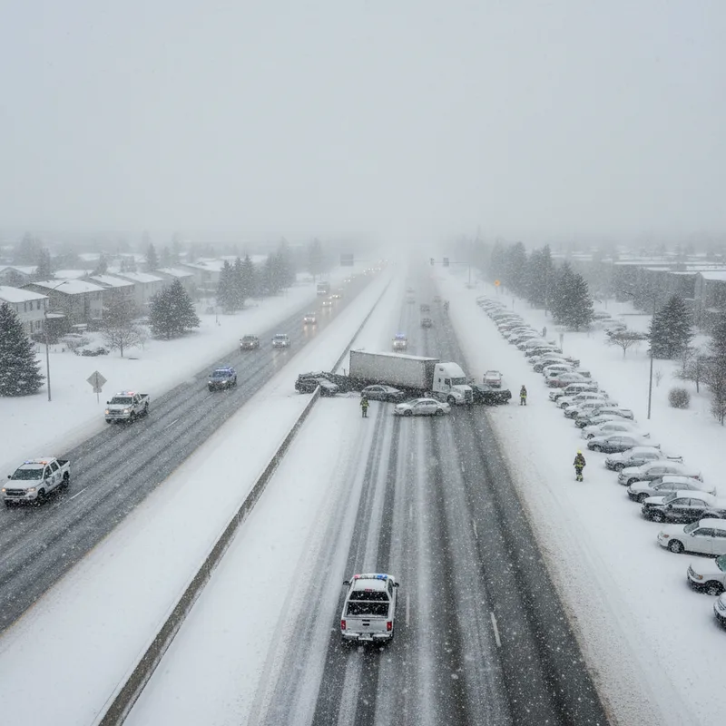
A sudden and intense snowstorm created treacherous conditions across north Calgary on Wednesday morning, leaving many commuters stranded and leading to widespread traffic disruptions. The Calgary Police Service reported a total of 159 vehicle collisions by 12:30 p.m., advising drivers to avoid travel as road conditions rapidly deteriorated.
Of the crashes reported, police confirmed that 27 resulted in injuries, while another 13 were hit-and-run incidents. The hazardous conditions were particularly concentrated along the northern section of Stoney Trail, where multiple collisions prompted police to issue a public warning against travel during the morning commute.
The storm created a strange meteorological split across the city. While residents in northern communities like Huntington Hills woke up to a thick blanket of snow, southern areas of Calgary saw little more than a light dusting, with many parts remaining completely dry. Traffic cameras starkly illustrated the difference, showing snowy, slick roads at 16th Avenue and Stoney Trail N.W. at the same time that pavement was clear at the intersection of Stoney Trail and Deerfoot Trail S.E.
A tale of two cities
The localized nature of the storm system caught many Calgarians by surprise. Drivers in the south, experiencing clear conditions, were met with gridlock and emergency vehicle sirens as they travelled north for work. The stark contrast in weather from one end of the city to the other highlighted Calgary's unique and often unpredictable weather patterns, which can be influenced by its proximity to the Rocky Mountains.
This phenomenon is not entirely uncommon in the region, where weather systems can be compact and highly localized. However, the intensity of this particular storm and its arrival after the official start of spring left many unprepared for the sudden return to mid-winter driving conditions. The City of Calgary's road crews, who monitor conditions through a network of sensors and cameras, faced the challenge of deploying resources to one specific area rather than conducting a city-wide snow clearing operation.
Managing such events requires a flexible and responsive strategy. The city's Snow and Ice Control (SNIC) program prioritizes major routes based on traffic volume, but a sudden, targeted storm can strain resources as crews are redirected to the most affected corridors. This incident serves as a reminder of the complex logistical challenges the city faces, from weather response to other major infrastructure concerns, such as the recent provincial inspection into Calgary's water crisis.
More significant than forecasted
Environment Canada had initially predicted light flurries for the day, but the system that developed was far more powerful than anticipated. Meteorologist Terri Lang explained that the storm behaved more like a summer thunderstorm, a relatively small system that can have an outsized impact when it stalls over a major urban area.
"This type of storm can be difficult to track," Lang said in an interview, noting that their compact size makes them harder to predict than large, sweeping weather fronts. The intensity of the snowfall in one area, while another remains dry, is a classic feature of these vigorous, localized systems.
While the timing of the snowfall may have felt unusual to some, Lang emphasized that Calgarians should not be quick to put away their snow shovels. March is, on average, the city's snowiest month, a fact that often clashes with the arrival of the spring equinox. Historical data shows Calgary receives an average of 22.7 centimetres of snow each March, making significant snowfalls a regular feature of early spring.
Not out of the woods yet
This week's storm is a potent reminder that spring in Alberta is a gradual transition rather than a sudden shift. The province is known for its late-season snowstorms, which can occur well into April and even May. These events often bring heavy, wet snow that can be particularly damaging to budding trees and power lines.
The unpredictability of spring weather poses ongoing challenges for residents, city planners, and event organizers. As the city looks forward to warmer months and major events like the Calgary Stampede, the potential for a "last blast of winter" always looms. This volatility is a defining characteristic of life on the Prairies.
Folks shouldn't be surprised to see snow in March, because it is the snowiest month, and we're not out of the woods yet in terms of the possibility of snow coming.
For now, Environment Canada advises residents to continue monitoring weather forecasts closely. While warmer temperatures are on the horizon, Lang cautions that the transitional season means more unpredictable weather could still be on the way before summer finally arrives.